Day 1: Ajax, ON to Ashtabula, Ohio (by car)
Wednesday, May 10
Sunny and bright. 20C
We were on the road just before 10am with about a five hour drive ahead of us to get to Ashtabula. Leaving by car is nice because we can always bring a few extra things with us before having to ultimately decide whether or not we have enough room in our bags for all of it.
They always seem so full! Bursting at the seams with different layers of clothes for various temperatures and levels of precipitation. Then there are the bottles and tubes of lotions and potions along with a whole assortment of various hygienic impliments. Not to mention the tool bag which is full of every conceivable mechanical remedy to pretty much any minor bicycle malfunction you can think of. In our ‘kitchen’ we’ve got a selection of plastic containers for dishes and cutlery, cups, knives, a cutting board, can opener, vegetable peeler, dish soap, dish cloth and tea towel. Not to mention the food we carry which varies from day to day. I’m actually understating the amount of stuff we bring with us because I don’t need to produce an official inventory list. The point I’m trying to make is that all of the little things do add up. Packing for a trip like this is a balancing act between traveling light and being prepared. Between roughing it and getting to enjoy yourself. I love the challenge and it is very satisfying knowing you have everything thing that you could possibly need and not an item more.
The long drive was actually pretty relaxing. We bounced ideas back and forth and slowly our plan is taking shape. It is exciting to have the flexibility to create our itinerary as we go along. One thing that is for certain, is that we’ve got 3 weeks on the road and that is already quite an accomplishment in and of itself.
After arriving in Ashtabula we stopped at the mobile phone store to get connected with new SIM cards. Then we stopped at one of our favorite food stores – Aldi – to select our supper. Finally, a drive down the main thoroughfare brought us to the Cedar Motel which checked all of our boxes for what we’re looking for in a motel. It’s official! The trip has begun.

Day 2: In and around Cleveland 45km
Thursday, May 11
Sunny and warm with a NW wind. 22C
The sun was up well before us this morning and when we pulled back the curtains, our room was flooded with sunshine surrounded by a bright blue sky. We finalized our packing as we ate our oatmeal. I culled 2 shirts, a pair of gloves and a pair of socks from my cache and stowed them away in the trunk of the car. We were on the road a little after 9am and took the interstate into Cleveland.
We still had to figure out where to park the car for a couple of weeks while we’re cycling and also where we’d be staying tonight. I had researched some long term parking options near the airport and although they were cost effective, they weren’t that close to the trail. We decided to ask around in person in a cluster of hotels that were nearby the trail. Some of the hotels were out of our price range. One of them – with a logo of a red roof – still brings back awful memories from a previous stay and both of us shuddered at the thought of having to stay there. At the first place we asked about parking they flat out turned us down. At the next place, after checking with the manager, they said sure. So we made a reservation to stay the night and got 2 weeks of free parking! These were the 2 things we needed to accomplish today and we had them completed before noon!
It was time to go for a ride so we drove down to the trail – less than a mile away- and got the bikes ready to ride. Tomorrow we’re heading south towards Akron, so we decided to ride north into downtown Cleveland. We loaded our bags onto the bikes so we’d get used to hauling weight and set off on the trail.
The Ohio to Erie Trail follows the Cuyahoga River at this point, but it also charts the course of the old towpath when barges were towed up and down the waterway by mules. We passed through lovely treed areas along the way as well as a smattering of light industrial areas before the valley opened up to reveal the remnants and hulking behemoths of the city’s steel industry. The mills and factories are strung together by a multitude of rail lines, all of which wend along the bottom of the river valley connecting the lake ports to the interior.

There are a lot of bridges in Cleveland that either span the river, or in some cases, the entire valley. Riding along was like touring an engineer’s arcade and passing underneath all the spans, the trail is an asphalt ribbon. We watched as the iconic skyline inched closer and eventually we ended up downtown, but unfortunately our progress toward the Lake Erie shore was halted by the Centre Street Swing Bridge closure. So we backtracked and found another bike route heading south but after a few more miles we decided just to admire the lake from afar.
Finding our way back was easy enough and we stopped to snack as we pedalled back to the car. The 45km that we rode was the furthest either of us has ridden this year and our legs felt good, but we didn’t want to overdo it. We are both looking forward to leaving the car behind and riding south in the morning.

Day 3: Independence to Akron 57km
Friday, May 12
Sunny and warm with cloud cover in the afternoon. 27C
Finally we are ready for heading south on the Ohio to Erie Trail! After sleeping in until 8am we slowly started getting our stuff organized. We thought that we’d be having a conversation with the manager about us leaving our car behind, but when we learned that she wouldn’t be in until almost noon we left her a note instead. Basically it said that we acknowledge that the hotel bears no responsibility for what may or may not happen to my car. Then we put the bike rack in the trunk and we were off.
It was about a mile to the trailhead and it was all downhill on a busy road. We stayed on the sidewalk, riding our brakes the whole way down and arrived safely in parking lot for Lock 39 – where we rode from yesterday. This is also the northern edge of the Cuyahoga Valley National Park which extends southwards almost all the way to Akron.
The park is beautiful, especially at this time of year when the leaves are finally unfurling from their spring buds. The understory is already bursting with greenery, but thankfully it seems that the bugs are late to the party. There were a lot of other people out on the trail including dog walkers, joggers, day-trippers and a few other long-haulers. There are many other access points along the length of the park and every parking lot we saw had people coming and going. There is even a special train – the Cuyahoga Valley Scenic Railway – that runs the length of the park. We didn’t ride the train today but we are trying to work it into our return trip.

We stopped in the shade for our first lunch break alongside one of the old locks near Boston. As nice as it is to have some warmer weather it was getting pretty hot in the sun. We were both slathered in sunscreen and when we are riding we create our own breeze, but stopping in the sun is a little too much when there is cool shade to be had. After lunch we browsed in the gift shop which had an attractive selection of just about everything you’d expect to find in a gift shop. We are planning to pay another visit when we have the car again so we can pick up some puzzles, books, bumper stickers, soap, chocolate and walking sticks!

In the afternoon we stopped a few more times for water and snacks while slowly getting closer and closer to Akron and there was a long climb up to the city with a summit of 600 feet. A lot of the accommodations in Akron are nowhere near the trail and in order to avoid having to pedal several more miles through town, we found an Air B&B near the trail on the south side of town. A little more scouting during a rest stop revealed an Aldi grocery store quite close to the trail too. So on the way by we stopped at the store to pick-up more food and then hopped on the trail again to get to our beds. We got slightly lost trying to find the B&B due to some confusion between Firestone Pkwy and Firestone Boulevard East, West, North and South. It seems like a lot of things in Akron are either called Firestone or Bridgestone as it is home to the latters technology centre. We did find our place in the end, nestled above a hole in the wall bar complete with solitary drinkers inside and curious imbibers out on the patio.
Once we hauled all of our stuff up the long staircase, we quickly settled in. We whipped up a delicious meal in the full kitchen although we only needed the microwave and a cutting board. Dinner was a quinoa salad with mac’n cheese and squash on the side – all things we’d been craving and talking about for hours! The apartment is nice overall although we can hear the jukebox through the floor and the TV is in the living room so we can’t watch it from bed. Other than that we are quite happy to be relaxing with our feet up on a Friday night after a fun and full day of riding.

Day 4: Akron to Massilon 45km
Saturday, May 13
Light rain in the morning, slowly clearing throughout the day. 23C

It was a little loud sleeping above a bar on a Friday night but it takes more than thumping bass and drunken chatter to keep us awake after riding all day. Not even the garbage truck at 6am can interfere with our rest and relaxation.
The sky was grey when we did get up and the forecast was calling for rain. Rain isn’t that big of a deal, especially when the temperature is fairly mild. We both carry rain jackets and today we’d be keeping them at the top of our packs. We have dry-sacks inside our panniers to keep all of our other stuff dry and we also have rain covers for our tool bags. After we carried our bags and bikes down to street level we noticed that the road was already wet. We also noticed a crudely rendered outline of a body in the parking space by my bike! That, I chalk up to an amateur’s attempt at subversive satire. We pulled out our rain coats and said goodbye to Park Place.
The rain went from light to steady as we made our way along the Firestone streets, boulevards, parks and parkways. By the time we got back on the trail the rain was dripping off our jackets on to the rest of us. We basically had the trail to ourselves in the morning, only passing two solo walkers. It is not as much fun stopping for picnics in the rain, but at the trail head in Clinton there were 3 covered shelters to choose from. We lingered longer than normal enjoying our crackers and cheese, tomatoes, avocado and leftover mac’n cheese. The rain seemed to be easing up by the time we were leaving but we kept our raincoats on so as not to provoke the weather keepers. The air seemed warmer too which is always a nice combination for riding in the rain.

A lot of the trail has been paved up until this point, but today the trail was mostly crushed limestone AKA stone dust. In dry conditions stone dust is the next best thing to asphalt, but in wet weather it can get a bit soft and is known in cycling jargon as peanut-buttery. In addition to slowing us down, the stone dust sticks to anything wet which in this case is all of us and every surface on our bikes. Normally this is not a big deal, in fact being covered in mud, dirt or dust is often seen as a badge of honour. However, when you are anticipating checking into a nice hotel and hoping to casually wheel your bikes into the lobby and up to your room it is a simple courtesy not to leave a gritty trail of driping stone dust in your wake. It was in this spirit of common decency that we stopped under an overpass to hose our bikes off using a water bottle and the fresh water of the Tuscarawas River. And, like most bathing rituals, we did feel cleaner afterwards.

The last leg of our ride was on asphalt, right up until we reached the outskirts of Massilon. Here the trail coincides with the town’s levee and it’s surface is of course, stone dust. Thankfully the rain had pretty well stopped by this point and our bikes remained relatively dry and therefore clean. We did one final wipedown with a rag before reaching the hotel, and we rolled up to the check-in desk looking like our driest and cheeriest selves. After squeezing our bikes into the elevator and gaining entry to our room, we peeled off our wet clothes, gritty socks and shoes. The view from our room looks out over Massilon’s historic downtown and the now the sun was shining! After freshening up we put on our wet shoes again and walked over to the Save-a-lot grocery store to see the dinner menu. It is a fairly small store so our cravings were not completely satisfied, but we managed to fill two bags which we gleefully carried back to our room. It started raining again and we were more than content to climb into bed and eat.

Day 5: Massilon to Millersburg 63km
Sunday, May 14 (Mother’s Day)
Sunny and mild with a NW wind
It was nice to see the sun again after our ride in the rain yesterday. Both of us slept in again, but once we were up it didn’t take long for us to get going. We took our breakfast with us for the first time on this trip, hoping to get 10km in before stopping to eat.

Once we reached the trail – named the Sippo Valley Trail in this section – we were enveloped in a wash of green. The sunlight was sprinkling through the trees leaving a shady path for us to follow. It seemed pretty quiet on the trail for a Sunday morning. There were some folks walking, but only a couple of other people on bikes. We found a nice bench in the shade to eat our oatmeal after riding the first 9km.

The trail took us into Dalton, a small town west of Massilon, then our route continued on rural roads for the next 17 miles. The countryside is beautiful here with rolling hills, farmland and forested areas.

At the top of our first hill we stopped to make a few adjustments and were greeted and joined by two other long-haul cyclists coming from the other direction. The couple – from Montana – had been riding from New Orleans! We swapped stories, strategies and a few questions before eventually saying our goodbyes.

We stopped for lunch at a picnic shelter in Holmesville and watched some Amish kids playing baseball. There is a large Amish population in this part of Ohio and they all ride e-bikes! The OTET picks up again in Holmesville and is called the Holmes County Trail (HCT). It is a dedicated recreational trail and a horse and buggy path – the only one like it in the U.S. The path is double-wide and posted with sign, bikes on one side, buggies on the other.
Being Sunday, the HCT was busy with horse and buggy traffic as well as local Amish on their e-bikes, and with them zipping around, it was us who felt like we were living in the past. We took a break later in the afternoon and sat and watched the traffic roll by.

Millersburg was only a few miles down the trail and our hotel only a few blocks from the trail. The grocery store was tucked behind the hotel and there was a laundromat next door too. We’ve been working on our planning, trying to find places to stay that are close to the trail and it makes a huge difference at the end of the day.
Day 6: Millersburg to Mount Vernon 70km
Monday, May 15
Cloudy in the morning and a sunny afternoon. 23C
This morning we broke the mold. After preparing oatmeal in our room we decided to take a look at the hotel’s breakfast offering. Somehow the scrambled eggs and sausages were calling to us, so we had our first hotel breakfast and packed our oatmeal for later.

The trail was only a short, downhill roll away from the hotel and we were back on the Holmes County Trail (HCT) in minutes. There was a long straightaway for a couple of miles and we followed along beside Killbuck Creek into the town of Killbuck. Leaving town however, were surprised that the signs had us going back on the highway. We rode the next 5 miles along the quiet and curvy hwy 520. The road traced the valley bottom, but there were some rolling hills that kept our legs pumping. Arriving in Glenmont, we were happy to see that we’d be rejoining the HCT (We later learned that a brigde is out on the trail, resulting in the lengthy detour). At the access point in Glenmont there were a few picnic tables, a gazebo and a port-a-potty. All good omens of things to come. It was here that we ate our oatmeal.
Excited to be off of the road and back on the placid trail through the woods, we set off. Immediately we noticed that we were riding uphill. Uphill climbs rarely exceed a 4 percent grade on rail trails because trains can’t traverse anything steeper than that. Sometimes these grades are almost imperceptible on a bike. Through experience we have learned that when our speed drops and our legs are still pumping away, we are going uphill. This is what we noticed here. No big deal, and still better than riding on the road. I even said that I could pedal like this all day. Well, we climbed uphill for 6km before finally cresting an even steeper peak. We had just climbed over Baddow Pass. At this point we were thankful for our second breakfast!

Like the saying goes, what goes up, must come down and we enjoyed an equally long and relatively gentle descent on the other side of Baddow Pass. Now we were in another county and riding on the Mohican Valley Trail (MVT). Our next point of interest was the Bridge of Dreams – the longest pedestrian-only covered bridge in Ohio.


We stopped for lunch before crossing the bridge at another well appointed rest stop. After our trail-side picnic we crossed the bridge over the Mohican River with still another 20 miles to go. We broke the afternoon ride first into 10km sections and then 5km as our legs waned. Apples, bananas and chocolate was the fuel we used to keep our strength up and slowly, but surely we inched closer to our destination. In Gambier at our final stop we were greeted by a woman on a recumbent bicycle. She asked where we were headed and where were we from. We started chatting and she announced that she is a host for Warm Showers – a network of reciprocating, cyclist friendly, free accommodations. She offered us a place to stay and recommended some local spots. We’d already booked a room, but we’ll be following up on the bakery she mentioned. The three of us rode together for a ways on the trail before we pulled away. She was in no rush to get home and we were making our final push on a long ride. Our spirits were lifted sufficiently and we forgot all about our tired legs as we made our way into Mount Vernon. Once again our hotel was close to the trail and the grocery store just down the road! Tomorrow we will be arriving in Columbus.
Day 7: Mount Vernon to Westerville 61km
Tuesday, May 16
Cloudy with the odd sprinkle of rain. SW light wind. 23C

We must be getting stronger because we had enough extra energy this morning to go for a walk around downtown Mount Vernon. We saw the historic town square and a fun piece of public art – inspired by a fountain in Toronto.
The Ohio to Erie Trail is a continuous trail from the Ohio River in Cincinnati to Lake Erie in Cleveland and it is made up of all sorts of trails, each with their own name. Today alone, we rode on 10 different ones: The Kokosing Gap Trail, The Heart of Ohio Trail, The Delaware County Trail, The Sandel Legacy Trail, The T.W. Hopper Trail, The Hoover Scenic Trail, The Genoa Trail, The Blue Star Trail, The Westerville Bike & Walk Route and The Alum Creek Trail. I had to keep notes to remember them all!

Aside from our usual trail-side snack breaks on a bench or just standing beside our bikes, we encountered some extraordinary reststops today. The closer we got to Columbus the nicer they seemed to get.

It did rain a little bit throughout the day, but never enough to get us or the trail wet. We’d get a bit damp and then the combination of the sun struggling to come out and the mild breeze would dry us off before we ever needed our rain jackets. The cloud cover also kept us from needing to reapply sunscreen which has become a daily chore.
We searched out a grocery store just off the trail on the way into Westerville, knowing that there weren’t any nearby the hotel where we’d be staying. Kroeger is a mega-supermarket and we spent awhile cruising the aisles before deciding what to order for dinner. Tonight’s meal was built around salsa and chips.
When we finally arrived at our hotel we were pleasantly surprised. We wheeled our bikes into the 7 story indoor atrium and rode up in the glass walled elevator to our room. The 2 room suite has more than enough space to stretch out in, and we haven’t even got to enjoy the sectional couch yet. We ate dinner at the table instead of in bed and we didn’t have to wash the dishes in the bathroom sink!

Tomorrow we’ve got a short ride into Columbus. We’ve got to finalize the details for the next leg of the trip and we’re planning on doing some sight-seeing and some relaxing!
Day 8: Westerville to Columbus 60km
Wednesday, May 17
Sunny but cool in the morning. NW wind. 20C
Today was supposed to be a short ride into downtown Columbus from Westerville and we were excited to be just taking it easy. After leaving the hotel after another egg and sausage breakfast, we got back on the trail heading south. Following the Alum Creek, the trail weaves its way through forested glens, past sports fields and past residential areas. It was cool in the shade, but the sun warmed us up when we were out in the open. After riding for almost an hour I remembered reading about the detour where a trail bridge was being replaced and sure enough we came to the dreaded ‘trail closed’ sign. Workers were on site working and without a bridge to cross over the creek we were looking for plan b. One option was to detour around on the road – a busy and narrow road with frequent truck traffic – and another was to retrace our route and connect to the Olentangy Trail which is another north/south trail following the Olentangy River into the city. We decided to take the long route and backtracked to where we started.

On the map, the alternate route is a lovely light green line that connects the Alum Creek Trail to the trail along the Olentangy River. In reality, the light green line follows along a busy road either on the sidewalk or as a bike lane, but only sometimes. So we rode that way for a bit before changing course again and finding a little bike trail to Sharon Woods. This is a big park north of Columbus and we found a way to cut through it to a better bike lane heading in our desired direction. Upon entering the park we discovered the path around Sharon Woods was freshly paved and bikes can only travel in one direction. We were intrigued and couldn’t resist riding the longway around. It was a beautiful ride and we had lunch on a bench there before continuing on.

The next leg of our alternate route was on roads and bike lanes, and we slowly worked our way across the city towards the Olentangy River. Finally we reached the Olentangy Trail and turned south. This trail took us through the Ohio State University campus and right past the iconic Ohio Stadium.

With only one more wrong turn, finally the Columbus skyline came into view. It wasn’t long after that, that we navigated our way from the trail to our downtown hotel. Had we gotten to Columbus earlier in the day we would have gone sightseeing anyway, so today’s round-a-bout way of getting there had us seeing sights we’d have probably missed otherwise. We had stopped to pick up our groceries on the way in, so we already had our supper with us when we checked in. After we ate we took a walk through part of the downtown and the nearby German Village and the Brewery District. We were back in our room before the street lights came on and as per our usual routine, we have our feet up in bed, working on the next leg of the trip.

Day 8: Rest Day
Thursday, May 18
Sunny and cool in the morning, warmer in the afternoon. 20C
Today was a much needed rest day for our legs. We knew that we wouldn’t be riding anywhere, but last night we realized that our plans were changing significantly. Originally we were aiming to ride all the way to Cincinnati on the OTEP, but due to unforseen circumstances we’ve had to come up with an alternative plan.
We weren’t able to secure accommodations at several places along the route between Columbus and Cincinnati. We tried searching multiple avenues, but there is a global Ham Radio convention in Xenia – Sounds like the beginning of a science fiction plot synopsis – and all the rooms in the towns both far and wide are fully booked. What can you do? So plan B was to rent a car and drive back to Cleveland to pick up my car. Then drive back to Columbus and figure the rest out from there. So that is what we did and we also did some sightseeing on the way.

The rental car place was a short walk from our hotel and because we had booked to stay in Columbus for 2 nights we were able to leave our bikes and baggage in the room to rest. It was a nice change to be sitting in a car instead of on a bike. The only pedaling I was doing was on the gas and the brakes. After we drove to Cleveland, picked up my car and dropped off the rental, we went back to Cuyahoga Valley National Park to the gift shop. There were some things we saw there we wanted to buy on our first time through, including a few books that were too heavy to travel with by bike. We also took a side trip to see Brandywine Falls which was a couple of miles from the trail, way up at the top of the valley side, another extra excursion we passed on when we traveled through earlier.
We had a picnic lunch, of course, and then drove the 2 hours back to Columbus. Grocery shopping was followed by dinner in our room and then we went out walking to see the Ohio Statehouse in Capitol Square. It was a quiet stroll and aside from the stately nature of the square, there is a really touching monument to Ohio veterans featuring a series of letters sent from soldiers inscribed in a limestone wall. Overall the day was a welcome change from riding and both of us feel like our legs needed a break. We haven’t decided exactly where we are headed tomorrow, but rain is forecasted so another day off is likely.

Day 9: in and around Columbus 37km and Columbus to Springfield by car.
Friday, May 19
Rain overnight, sunny and humid. 24C
We were expecting a rain day today and planned on entertaining ourselves indoors somewhere. The pavement was wet looking peering out of the hotel window, but the sun was just breaking through the clouds and it was already 20C outside. Now the forecast was for sun! We’d been meaning to rent e-bikes to so that is what we did.
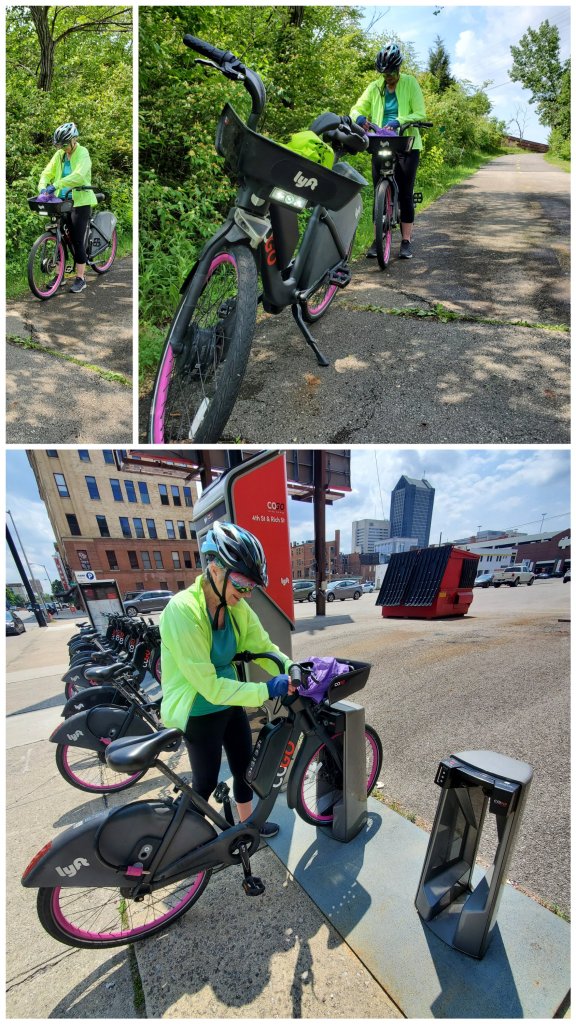
After we ate breakfast we loaded our bikes onto the bike rack and loaded our luggage in the car. There was a COGO e-bike stand across the street, so we ambled over to unlock 2 bikes. It didn’t work the first time we tried it, but after both of us downloaded the app and uploaded our credit card info, presto! The bikes are fun to ride and for the first little while we played around with the toggle controls that sort of simulate gears on a bike. We rode out of the downtown towards the section of the trail we missed riding on the other day. It took almost an hour to reach the point where the bridge is out at Innes Park. For some reason we didn’t bring any food with us and we were starting to get hungry for lunch. When I pulled out my phone to see what was nearby, there was a notification saying that one of the e-bikes had a low battery. I looked up the nearest docking station that had e-bikes available and charted a new course. Wendy’s bike battery gave out first so we switched bikes. Pedaling a heavy e-bike with no ‘e’ isn’t much fun. It’s manageable on the flats and going downhill but a bit of a struggle going up. We limped to the charging station and swapped out our tired bikes for fresh ones. Then it was off to the grocery store for some fruit to tide us over.
After our own energy boost we made our way back downtown and returned the bikes to where we picked them up. Back across the street was the car and we hopped in and left the hotel parking lot. We found a shaded street by Topiary Park to have our late lunch and to decide where to go next. We’d like to be in Dayton on Monday so we drove west, ending up in Springfield – about a 40 minute drive and halfway to Dayton. Springfield has a trail running through it and we plan on riding some of it tomorrow.
Day 10: Day trips from Springfield on the Little Miami Trail
- Yellow Springs to Xenia 32km
- From Waynesville / Corwin 12km
Saturday, May 20
Overnight rain and clearing by mid morning. 23C

Traveling by bike with a car opens up a lot of possibilities and sometimes the hardest part is narrowing down what to do, considering all that you could do. Today we decided to stay close to Springfield and enjoy the nearby trails. And there are a lot of nearby trails!

We drove a few miles to the Glen Helen Nature Preserve where we could could park the car and access the Little Miami Scenic Trail. Then we rode south to Xenia because we were curious to see what a place called Xenia would look like.

Xenia is an interesting little city. This is where Hamvention – the Ham Radio Convention – is happening this weekend and why we couldn’t find a place to stay anywhere near it. There is a nice looking downtown and main street. Most impressive is the Xenia Station Bike Hub where 5 different bike trails converge. From the hub you can ride to Columbus, Cincinnati, Dayton, Springfield or Jamestown. All the trails have numbered routes, trail names and are colour coded. It really was a hub of bike activity and there was a fun looking playground.

We stopped for lunch across from the Farmer’s Market and looked around in a few shops and a bakery.
After lunch we rode back to where we had parked in Yellow Springs. Then we took a drive south to Waynesville along some beautiful country roads. Waynesville is another town where we would’ve been pedaling through on our way to Cincinnati. It too, was a neat little town, nothing like what we were expecting to see. After strolling along the main Street we hopped back in the car and drove less than a mile to where the OTET / Little Miami Scenic Trail comes through the neighbouring town of Corwin. Both of us were feeling a bit lazy by this point, but we decided to go for a short ride anyway. We rode north from Waynesville/Corwin just long enough to earn a snack break. We stopped at a bench, snacked and then pedaled back to the car.
I may be starting to take these trails for granted, and I feel like I’m failing to accurately describe how great they truly are. Most of them are entirely paved which makes for good riding, and they are all really well signed – including mileage and maps – which is helpful when passing through cities and towns. There are usually mature trees arcing up over the trail and a lush understory that provides ample shade and shelter from the wind. There are open areas too, so you also get some sun on your skin. I think we’ve just gotten quite used to the beauty of it all, so when I’m writing ‘riding along the trail’ I’m forgetting to mention the little chipmunks darting back and forth across the trail, and the deer leaping back into the woods just as you round a bend. There are tons of birds too. There are historic sites here and there that help to make the connection as to how these trails came into existence. It’s really rather fascinating. Perhaps the most impressive thing is the scope of the trail network. The state of Ohio has about 30 different trails ranging in length from a few miles to over 300 miles long. So when I write that we went for a short ride on the trail, there is a whole world of experience that is not effectively being communicated.

We found a different hotel to stay in tonight in Springfield. The room feels a little emptier without bikes and bags everywhere, but at least we can keep an eye on them out the window.
Day 11:
- In and around Springfield 52km
- Springfield to Dayton by car
Sunday, May 21
Sunny and cool in the morning, warmer in the afternoon. 24C

It was another perfect day for a ride and there are more trails around here than we have time. We wanted to see more of Springfield so we drove north several miles to Bowlusville Park and accessed the Simon Kenton trail from there. Then we started riding south into, through and then out of Springfield on the Little Miami Scenic Trail to Beatty Station – about 20km. We felt like we didn’t really see that much of the downtown and after consulting our maps again over lunch, we realized that we’d have to take an alternate route on the way back, in order to see more sights.

On the return trip, when we reached downtown, we rode the city streets to get a better feel for the city. Trails are generally more scenic, more relaxing and safer than riding on the road, but usually they bypass the city’s high street – as train lines often did.


After crossing over Buck Creek – the water way running through Springfield from the Clarence J Brown Reservoir to the Little Miami River – we passed by the Springfield Museum of Art and Veterans Park. From there we took the Buck Creek Trail upstream, passing through Old Reid Park to Buck Creek State Park. Snack time!

From there we backtracked along the Buck Creek Trail until it met up with the Simon Kenton Trail and we were back riding on the route we came in on. There were quite a few bridges and tunnels that easily brought us from the city out to the country side. Within no time we were back at the car and ready to move on.
Dayton was our next destination and about a half hour drive by car. We are booked in for 2 nights and our hotel is in a great location for riding – right downtown by the Miami River. After checking in and a delicious dinner in our room we took a stroll along the river to get our bearings. Again there are too many trails here to do them all, but we’ll try our best to ride as much as we can.

Day 12: In and around Dayton
- Riverscape Park to Huffman Prairie Flying Field 35km
- Riverscape Park to Wegerzyn Gardens 12km
In the morning we started the day with a short walk through downtown Dayton to warm up our legs. Breakfast smelled better when we got back to the hotel and we were just in time to serve ourselves scrambled eggs and Canadian bacon which was actually just ham. We ran a load of wash, hung it up to dry and then wheeled the bikes out of the hotel and onto the trail.
Just outside our door is the Great Miami River Trail, but where the Mad River joins the Miami we branched off to the Mad River Trail. We rode to Eastman Park, past the Mad River Run to the Wright Brother’s Memorial. From there we branched off on to the Wright Brothers-Huffman Prairie Trail which took us to the Hoffman Prairie Flying Field in the Wright Patterson Airforce Base. The trails seamlessly transition from one to another, but I’m keeping track of all the names for future reference.

The flying field was fascinating. Imagining the Wright brothers messing around in that field over a hundred years ago. That same field is now surrounded by a massive airforce base. That was the turnaround point for our ride, but we stopped at Huffman Park for our picnic lunch before retracing our route back downtown.

Later in the afternoon we went out by car to do some shopping. We browsed in a shoe store and a labyrinthine book store before wandering through Trader Joe’s. We went to Meijer for groceries and prepared another tasty dinner in our room. After dinner we went out for an evening ride – something we rarely do.
Again, leaving the hotel we started on the Great Miami River Trail and crossed over the pedestrian bridge to Deeds Point Park and rode past Kettering Field and Island Park. From there we switched over to the Stillwater River Trail, which follows – you guessed it – the Stillwater River. We went a few miles, as far as Wegerzyn Gardens and then turned back. The temperature outside was just perfect for riding, still warm, but not hot and barely a breeze. There were lots of people out too which is always a nice feeling, smiling and waving as we ride past. We got back before the sunset, ran another load of laundry and finally put our feet up to relax.

Day 13: In and around Dayton 34km
- Wolf Creek Trail
- Great Miami River Trail
Tuesday, May 23
Sunny and warm with a few fairweather clouds. 28C
Another day of riding in Dayton had us following the Miami River south. We took a short side trip on the Wolf Creek Trail to see the Paul Laurence Dunbar House. He was an important African-American writer and was close friends with the Wright brothers who lived and worked nearby. After that we visited the sight of the Wright brother’s bicycle shop. It has been restored and is also an interpretive centre that shows how the brother’s work in making bicycles aided their experiments in aviation.

When we finished soaking up all of the interesting information at the Dayton Aviation Heritage National Historical Park, we got back on the bikes and back to the trail. Wolf Creek to Great Miami and the headed south. We rode right alongside the riverbank as well as higher up the embankment. The trail goes under all the bridges with ‘exit ramps’ here and there that take you up to street level.

We rode as far as West Carrollton before we stopped for lunch. It was a lovely sunny day, but it was starting to get hot by this point in the day. We took it easy on the ride back into Dayton and we stopped at Carillon Park for a short break. After we got back to the hotel we went out for a walk downtown to use some different muscles. We stopped at The Rabbit Hole Bookstore. A well curated charity-boutique shop where every book is a dollar. One of the perks of traveling with a car is that we don’t need to restrain our purchases due to weight or size. We had early supper in our room and spent some time planning our next stop – Cincinnati.
Day 14:
- Milford: Little Miami State Park
- Milford to Cincinnati to Covington, Kentucky by car

We left Dayton after breakfast and Cincinnati was only an hour away by car so we stopped in Milford to do some riding on the Little Miami Scenic Trail (part of the OTET). Because we weren’t able to ride from Columbus to Cincinnati as we had originally planned, we are trying to ride some of the trail in different segments. We didn’t realize that Milford is a bit of a trail junction and is also at the southern end of Little Miami State Park. We’ve found that State Parks are usually really nice for riding – lots of tree cover, great scenery and rest areas – and they are often quite busy.

There were so many people on bikes on this stretch of trail and on a Wednesday morning of all times. We got the last parking spot which should have clued us in to how popular the trail is around here. Of course there were lots of lycra-road-racers, but there were all sorts of other riders too. Plus rollerbladers, walkers, dogs and horses too. We really had to pay attention to who was ahead of you and who was coming up from behind. There was a chorus of bike bells ringing and calls for ‘on the left’ – the official announcement for overtaking people on the trail.
We rode 10km south from Milford and then back. After a trail-side picnic we rode north for 10km and then back. During a break I hiked down to the river’s edge and was rewarded with a placid scene of stillness and green. Once we were back at the parking lot we readied the bikes on the rack, had a quick snack and then set off for Cincinnati.

We took Hwy 50 from Milford and it brought us into Cincinnati on the Columbia Parkway which follows along beside the Ohio River. It was a very scenic drive and then all of the sudden, we were downtown. We are staying in Covington, Kentucky – across the river from Cincinnati – which seems like an interesting spot. It is close to where we want to ride in downtown Cincinnati and it is a bit less expensive too. After we checked in, checked out the grocery store and settled in, we had dinner in our room. After that we went for a short walk to stretch our legs.

Our short walk got extended once we got going and we ended up over in Cincinnati. In the morning we’ll be riding across the John A. Roebling Suspension Bridge instead of walking, so we were actually doing some scouting too. I love cities with bridges and rivers so, like Dayton, I’m sure this will be an exciting few days.

Day 15: In and around Cincinnati 54km
- Little Miami Scenic Trail
- Ohio River Trail
Thursday, May 25
Sunny and cool with a gusty NE wind. 22C
Today we re-enacted riding into Cincinnati, but first, we had to ride out of the city. We took our breakfast with us on the road and ate at Riverside Park after crossing over the John A. Roebling Suspension Bridge again. We found a nice bench beside a flying pig play structure. Cincinnati a.k.a Porkopolis, was once the biggest pork processing centre in the country. The flying pig is said to represent the angelic spirits of all the slaughtered swine.

The trail along the downtown waterfront is really nice. There are all sorts of parks, amusements and amenities along the way. We didn’t pay very close attention on the way out, knowing we’d be coming back the same way. It is actually a really good way to ride because you can make note of things you want to get a closet look at. A mile or two out of downtown the route diverts to a bike lane along Hwy 52. We rode past the impressive looking Cincinnati Water Works and a brightly painted Bengal’s Bar called Who Dey (think gonna beat our Bengals N-O-B-O-D-Y). Sights like these and keeping an eye on traffic, pass the time differently than riding on a trail through the woods. We did end up back on the trail, and in no time, we were at Clear Creek Park – our turn-around point on yesterday’s ride.

On the way back into downtown Cincinnati we had the wind at our backs and we were flying along. We stopped for a picnic lunch by the Schmidt Boat Launch before continuing on our ride. The section of on-road riding was even shorter on the way back. Because we paid a little more attention, we picked-up the Ohio River Trail for part of the ride where we had missed it on the way out.
Another thing we noticed on the way out and paid more attention to on the way back was this interesting mirrored sculpture in T.M. Berry International Friendship Park. The linear park, named after the city’s first African-American mayor, features public art and flora representing the 5 continents. We had a great time posing and peering in and around “Castle of I”, representing Europe.

We crossed back into Kentucky on the Purple People pedestrian bridge and spent some time biking around in Newport. There are a few short trails there including the Levy Walk, but the streets weren’t that busy so we made our way back to Covington by crossing the Licking River and riding along one of the main strips. There is a vibrant feel to the area. It has the buzz of a big city without the skyscrapers and mega-infrastructure.

We were back at the hotel by 4pm and had and early supper with our feet up. We prised ourselves out of bed by claiming we’d go for a short walk, but both of us knew that once we went out we’dbe glad that we did. We walked over to Cincinnati on the Clay Wade Bailey Bridge this time and explored a little more of the lower downtown. There were a lot of other people downtown too. There was a Cincinnati Red’s baseball game earlier so fans were out consoling themselves and we heard some live music coming from one of the amohitheatres by the waterfront. We completed the loop by crossing over on the Roebling Bridge and made our way back to the hotel on the river trail we discovered earlier. Cincinnati is much more interesting than either of us thought it would be. It is a big city, but the way that it’s nestled in the tree-covered river valley gives it an enclosed feeling that makes it seem more contained and cozy. We’ve only seen a glimpse in our time here, but we are intrigued
Day 16: Leaving Cincinnati
- Devou Park, Covington, KY
- Fort Ancient Earthworks
- Spending the weekend in Xenia
Friday, May 26 (Memorial Day Weekend)
Sunny and warm. 26C
We had a lot of fun in Cincinnati, but it was time to move on. We have a few days left and there are still some places we want to see and a few trails we want to ride before making our way back north to Ontario.

The drive up to the lookout at Devou Park provided an amazing view of Cincinnati and Covington. That is where we ate our breakfast. Afterwards we took a short walk on a trail through the woods and decided that we might take a break from riding today.
Fort Ancient Earthworks was another place we wanted to visit, so we drove there in about half an hour. The first part of the drive was on the interstate and the second half was on quiet country roads. We had to cross from one side of the Little Miami River to the other and the road literally plunged down one side of the valley and twisted up the other in rather dramatic fashion. Atop the bluffs on the east side of the river sits North America’s largest ancient hilltop enclosure.

The earthen mounds – built 2,000 years ago – are a fascinating glimpse into the history of not only the people who built them, but the people who inhabited the area for centuries afterwards. The museum there offered an array of exhibits and insights, while the grounds provided the physical context to the history. We spent a few hours there including a picnic lunch and a short hike down to the river and then back up. The bicycle trail goes right past Fort Ancient down by the river. We briefly thought about taking a short ride, but again, we thought a rest day from riding was in order.

Later in the afternoon we drove to Xenia, again, and that is where we’ll be staying for the next 2 nights. The trail hub here is incredible and we plan on doing some day rides from here (see the Day 10 blog post for description of Xenia Trail Hub).
Day 17: All roads to Xenia
- Xenia to Cedarville – return 29km
- Xenia to Jamestown – return 40km
Saturday, May 27 (Memorial Day weekend)
Sunny and warm. Light cloud building in the afternoon. NE wind. 26C

We had a busy day of riding planned and got an early start by taking our breakfast on the road (trail).

Leaving Xenia on the Ohio to Erie Trail (OTET), a.k.a Bikeway #1, we were traveling northeast towards Columbus into a headwind. The trees on either side of the trail provided some protection from the strong breeze but we could feel our speed drop in the more open sections. We rode over 10km before pulling over at the side of the trail to eat our oatmeal. It was cool in the shade and getting warm in the sun, so we had some of each at the spot where we stopped.

The trip to Cedarville and back was the quintessential ride on a rail trail. Long straight stretches, bridges, tunnels, forests, fields, towns, crossroads and critters. One of the best things about the ride was getting to turn around and ride back with the wind at our backs. Uphill sections became downhill ones and vice versa. Even the scenery is surprisingly different coming from the opposite direction. We arrived back at the Xenia Station Bike Hub feeling more energized than when we left.
Taking Bikeway #4 – a.k.a. the Xenia-Jamestown Connector – on our second ride, we were riding southeast and again had a bit of a headwind. The surroundings were similar, but different enough to still feel like we were seeing something for the first time. We stopped for a picnic lunch at a bench along the trail and then continued on to Jamestown. It didn’t take long to do a quick circuit of town and from what we saw of the old downtown, it looked like it had seen better days.

We passed a skydiving place twice today, and the second time we noticed their red plane circling high above us. We stopped to watch and sure enough, 3 parachutes appeared like pin pricks in the sky. It was neat to watch them slowly circle down, although the first one came down so fast that we thought the chute had failed! They were fine, and in fact, made quite a skillful landing.

When we arrived back at the station in Xenia for the second time we still felt great. We rewarded ourselves with a walk to the bakery where we carefully selected our sweet trophies. We arrived back at our room just in time for dinner!
I’ve been meaning to take more pictures of our delicious meals, but I always forget to. Halfway through eating it, it never looks as good. Tonight I got a picture of our appetizer course, the salad; artisan lettuce, frozen cucumber, avocado, american bosc pear, sunflower and pumpkin seeds with citrus poppyseed dressing. We also had a Tika Masala over rice which we prepared in the microwave. And dessert was a lemon and lavender scone and a piece of peanut butter ritz pie.

Day 18: Travel Day to Pittsburgh, PA
- Xenia, OH to Pittsburgh, PA
- Sightseeing in Pittsburgh
Sunday, May 28 (Memorial Day weekend)
High wispy cloud with glimpses of sun. 26C
Last night we decided to drive back via Pittsburgh instead of Cleveland and we booked an online special where you get a room at one of 3 hotels, but you don’t find out which one until you pay for it. Once we knew our final destination, we plotted our course, and in the morning we said farewell to Xenia.
I have detailed my admiration of American rest stops before, but I must reiterate how brilliant they are in their simplicity: a place to park, bathrooms-a-plenty, green space with trees and shade, picnic tables, bbqs, vending machines and a walking trail. What they don’t have – or need – is gas stations and fast food restaurants. We stopped at 2 of them today, primarily to use the rest room, but on both occasions we took a stroll around the grounds to stretch our legs. At one in Pennsylvania we had a picnic lunch and were summarily assaulted by country flies.

It took us most of the day to get to Pittsburgh. I drove and my Mom navigated – using a selection of maps. When we got close to the city our paper maps were lacking the detail we needed, so we enlisted the services of Madame Google. The topography of the Pittsburgh area is incredible. There are so many hills, valleys and trees that you can’t really tell where you are in relation to anything else. All we had was the serene and dispassionate voice of Mme G to lead us through the twisting road network of the city.
In the area that we were, all the roads look the same. They either follow the bottom of a valley between tree covered hills or they snake up one side of said hills and down the other. The roads and highways look very similar, so it’s hard to tell if you should be going 35 or 70, until you come to your turn and then chances are it’s too late. We did find the hotel and we checked-in and unloaded. Then we selected our next destination – Aldi and Giant Eagle grocery stores. Mme G worked her magic again and we faithfully obeyed. We drove up and up and up, and down and down and down half a dozen major hills to get to the store. It was exhausting, and we were driving in a car!
After dinner we went out too see some of the city. We started at the Grandview Overlook to get some perspective. Once you get up out of the valleys you can really see the shape of the river valleys. In Pittsburgh, the Allegheny River meets the Monongahela River, and together, they form the Ohio River. From the overlook we also saw 2 deer grazing through the neighborhood.

From there we drove down to Point State Park – the confluence of the rivers – to take a look around. The open space around the rivers felt refreshing after the closeness of being cloistered in the hills. We spent over an hour wandering around the park. We walked along the Allegheny and the Monongahela.

We walked under some of the bridges.

And we spent some time by the reflecting pool.

When we got back to the car we had another round of fun with Mme G leading the way. I kept missing her turn suggestions and she kept on suggesting new ones. We got a good tour of the city and laughed our way back to the hotel.
Day 19: A Surprise Ride
- Pittsburg, PA to Fredonia, NY (by car)
- Morraine State Park ride: 25km
Monday, May 29 (Memorial Day)
Sunny and warm. 29C
We had a long drive planned today so we checked-out with our oatmeal and bid adieu to Pittsburgh. Heading North on the I-79 we were looking forward to having breakfast at a nice rest stop. As we got hungrier and no signs mentioned upcoming rest stops, we opted to get off the highway at the next exit. As it turns out there was a State Park a mile down the road, so we went there in search of a shady bench and some bathrooms.
Unbeknownst to us, Moraine State Park has an incredible 7 mile paved bike path. The universe was speaking to us and apparently, we were listening. After we ate, we got the bikes ready and started off on the trail. Not anything like a rail trail, this path twists and turns, both up and down, as it skirts the shoreline of Lake Arthur. There is a bike rental operation there and the place was busy. The first few minutes of the ride were spent skillfully overtaking Sunday riders and family groups who looked like they hadn’t been on bikes in years. After a few delicate maneuvers, like passing before blind corners, we found our own space and we could really start to ride.

The long straight stretches typical of rail trails are great for contemplation, conversation and scanning the surroundings. It’s easy to maintain a set pace and pedaling becomes automatic. The trail at Morraine State Park was nothing like that. It was more like a toned down rollercoaster. It seemed like each and every turn was preceeded by a quick climb or a curving descent. We were switching gears like mad to keep up our momentum and communication was limited to yes or no questions shouted over-the-shoulder. When we did catch up to one another we both had wide-eyed smiles.

The ride back was a little more restrained and we could anticipate a couple of the hardest corners. It’s a good thing that there were so many other people out riding and walking, otherwise the temptation to really let loose might have been too much. We were so lucky to have stumbled across this park. Considering we were just looking for a nice spot to eat our oatmeal, I almost feel a little foolish for not having had this on our must-ride list. Like I said, the universe was talking, and we were listening.

When we continued our drive north on the highway, we did end up seeing signs for rest stops, and we did stop at one for lunch. We sat at a picnic table in the shade beside a luscious stand of trees. Later in the day we ended up in Erie, Pennsylvania and did some shopping before driving another hour east to Fredonia and Dunkirk on Lake Erie. We are spending the night there – the last of our trip – and tomorrow we will be crossing back into Canada.

